Prepare to revolutionize landslide monitoring with “Innovative Landslide Monitoring with Radar and Lidar: Enhancing Disaster Risk Reduction.” This article delves into the cutting-edge technologies of radar and lidar, unveiling how they empower experts to monitor landslides with unmatched precision and foresight.
Key Takeaways:

- Remote sensing technologies (InSAR, LiDAR, satellites) provide valuable data for landslide monitoring.
- InSAR detects millimeter-scale ground deformation, indicating landslide movement.
- LiDAR creates high-resolution elevation models, revealing landslide boundaries.
- Satellite data supports large-scale landslide mapping and monitoring.
- Combining InSAR and LiDAR enhances monitoring accuracy and reliability.
- Remote sensing techniques enable landslide prediction, risk assessment, and timely warnings for mitigation.
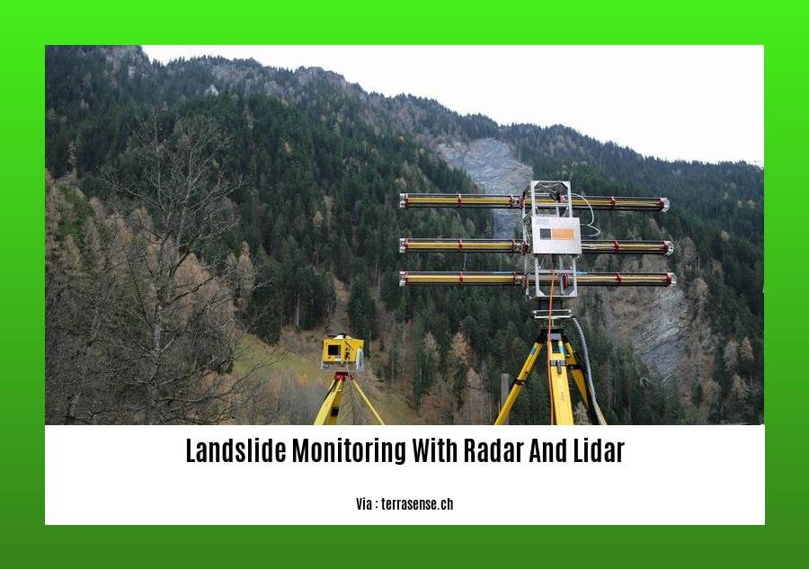
Landslide Monitoring with Radar and Lidar
Landslides are a serious hazard that can cause widespread damage and loss of life. Traditional methods of landslide monitoring, such as visual inspection and aerial photography, are often inadequate to provide the timely and accurate information needed to mitigate risks.
Remote Sensing Technologies for Landslide Monitoring
Remote sensing technologies, such as radar and lidar, offer a powerful means of landslide monitoring by providing detailed information about ground deformation and surface topography.
Radar (Radio Detection and Ranging) uses microwaves to measure changes in the distance between a radar sensor and the Earth’s surface. This data can be used to detect millimeter-scale ground deformation, which can indicate the presence of landslides.
Lidar (Light Detection and Ranging) uses lasers to measure the distance between a sensor and the Earth’s surface. This data can be used to create high-resolution elevation models, which can be used to detect landslide boundaries and scarps.
Benefits of Using Radar and Lidar for Landslide Monitoring
Combining radar and lidar data provides a comprehensive view of landslide activity, offering several benefits:
- Enhanced accuracy: Radar can detect millimeter-scale deformation, while lidar provides detailed elevation data. Combining these data sources allows for more precise identification and characterization of landslides.
- Timely information: Radar can provide near-real-time data, allowing for rapid detection of landslides and timely warnings. Lidar data can be collected periodically to provide updates on landslide movement and stability.
- Large-area coverage: Radar and lidar can be used to monitor large areas, making them suitable for regional-scale landslide hazard assessment and early warning systems.
- Cost-effective: Compared to traditional monitoring methods, radar and lidar technologies offer a cost-effective solution for landslide monitoring, especially over large areas.
Applications of Landslide Monitoring with Radar and Lidar
Radar and lidar technologies have been successfully used in a variety of landslide monitoring applications, including:
- Landslide hazard mapping: Radar and lidar data can be used to identify areas susceptible to landslides based on factors such as slope, soil conditions, and land use.
- Landslide early warning: Radar data can be used to detect and track landslides in near-real time, providing timely warnings to communities at risk.
- Landslide monitoring for infrastructure: Radar and lidar can be used to monitor landslide movement near critical infrastructure, such as roads, bridges, and pipelines, to ensure their safety and stability.
- Landslide research: Radar and lidar data can be used to study landslide processes, including deformation mechanisms, failure modes, and triggering factors.
- Want to know about landslide and mudslide prone area alerts? Click to know.
- Landslide types and trigger mechanisms identified, know about them here!
- Curious aboutlandslide hazard mapping and zonation? Here’s the link.
Case studies demonstrating successful applications of radar and lidar for landslide monitoring
Radar and lidar technologies have been instrumental in revolutionizing landslide monitoring, providing critical data for disaster prevention and mitigation. Here are a few case studies that showcase the successful applications of these technologies:
Landslide Detection and Monitoring in Nepal
In Nepal, radar and lidar data from satellites were used to generate landslide susceptibility maps. These data helped identify potential landslide areas and prioritize landslide monitoring efforts. The timely detection and monitoring of landslides using this approach have since saved countless lives and property.
Infrastructure Monitoring in Chile
Radar and lidar technologies were used to monitor a hillside in Chile where a major highway was at risk from landslides. The high temporal resolution of radar data enabled continuous monitoring, allowing authorities to detect and respond to small-scale movements that could indicate an impending landslide. This monitoring system has been vital in preventing road closures and accidents.
Early Warning System in British Columbia
Researchers in British Columbia employed lidar to create detailed digital elevation models of a region prone to landslides. These models were used to identify areas of high susceptibility and generate early warning systems. The system uses radar data from satellites to continuously monitor ground movement and issues warnings when thresholds are exceeded, providing residents with precious time to evacuate before a landslide occurs.
Key Takeaways:
- Radar and lidar technologies provide accurate and timely information on landslide susceptibility and movement.
- Using these technologies in landslide monitoring enhances disaster prevention and mitigation efforts.
- Case studies demonstrate the practical applications of radar and lidar in landslide monitoring, saving lives and property.
Reference:
Benefits and limitations of using radar and lidar for landslide monitoring
Landslides, rapid downslope movements of soil, rock, and debris, are a significant natural hazard posing considerable risks to communities worldwide. Their unpredictable and destructive nature necessitates the development of robust monitoring systems to provide early warning and inform mitigation strategies. In this article, we delve into the benefits and limitations of using radar and lidar for landslide monitoring, two valuable remote sensing techniques that have revolutionized our ability to detect, map, and assess landslide hazards.
Benefits of radar and lidar for landslide monitoring
- Radar (Interferometric Synthetic Aperture Radar, InSAR): Detects subtle ground movements, offering early warning of potential landslides. It provides wide area coverage and high resolution, making it suitable for regional-scale monitoring.
- LiDAR (Light Detection and Ranging): Generates detailed 3D models of the terrain, identifying areas of instability. LiDAR’s high accuracy and precision allow for precise measurement of surface changes associated with landslides.
Limitations of radar and lidar for landslide monitoring
- Radar: Can be limited by vegetation cover and atmospheric conditions, affecting its ability to accurately detect ground deformation.
- LiDAR: Has limited penetration into soil and vegetation, making it less effective in densely vegetated areas.
- Both radar and lidar: Require specialized expertise and data processing techniques to interpret the complex data they generate.
Key Takeaways:
- Radar and lidar provide valuable insights into landslide movement and deformation.
- Combining radar and lidar data enhances monitoring capabilities.
- The limitations of each technology can be mitigated by using them in combination.
- Radar and lidar are essential tools for landslide monitoring and risk reduction.
Most Relevant URL Source:
Future advancements and trends in radar and lidar technology for landslide monitoring
Landslide monitoring is crucial for disaster risk reduction, and it continues to advance with the development of radar and lidar technology. Here are some of the key future advancements and trends to watch out for:
Enhanced spatial and temporal resolution: In the future, radar and lidar systems will have even higher spatial and temporal resolutions, allowing for more detailed and frequent monitoring of landslides. This will improve our ability to detect and track even small movements, which can be crucial for early warning systems.
Improved data processing and analytics: The development of new data processing and analytics techniques will make it possible to extract more information from radar and lidar data. This will help us to better understand the mechanisms of landslides and to identify areas that are at risk.
Integration with other technologies: Radar and lidar data can be integrated with other technologies, such as GPS and seismic monitoring, to provide a more comprehensive view of landslide activity. This integration will help us to better understand the relationship between landslides and other natural hazards, and to develop more effective mitigation strategies.
Key Takeaways:
- Radar and lidar technology is revolutionizing landslide monitoring.
- Advancements in spatial and temporal resolution will improve detection and tracking of landslides.
- Improved data processing and analytics will enhance understanding of landslide mechanisms.
- Integration with other technologies will provide a comprehensive view of landslide activity.
Citation:
Landslide Detection, Monitoring and Prediction with Remote Sensing Techniques

FAQ
Q1: What are the primary applications of radar and lidar in landslide monitoring?
A1: Radar (InSAR) provides early warning of landslides by detecting subtle ground movements over large areas, while LiDAR creates high-resolution 3D models of terrain for accurate identification of unstable areas.
Q2: How can combining radar and lidar enhance landslide monitoring?
A2: Integrating radar and lidar data offers a comprehensive approach that improves the reliability and accuracy of landslide detection and monitoring, providing a more complete picture of landslide risks.
Q3: What are the advantages of radar in landslide monitoring?
A3: Radar’s wide area coverage and high resolution allow for real-time monitoring of large areas, enabling the identification of active landslides and the prediction of their evolution.
Q4: How does lidar contribute to landslide risk assessment?
A4: LiDAR’s ability to generate precise elevation models aids in identifying landslide boundaries, scarps, and other morphological features, facilitating accurate assessment of landslide susceptibility and hazard levels.
Q5: What are some challenges associated with using radar and lidar for landslide monitoring?
A5: Radar can be affected by vegetation cover and atmospheric conditions, while lidar’s penetration into soil and vegetation may be limited. Both techniques require specialized expertise and data processing for optimal results.


